-

2008 Angel Island Fire, San Francisco Bay, California
On the evening of October 12, 2008 a wildfire broke out on Angel Island that eventually claimed 75% of the land surface. This exposure was captured at midnight, three hours after the start of the blaze.
-

2008 Royce Butte Fire, Crescent Lake Junction, Oregon-4 Months Later
The Royce Butte Fire was a human-caused wildfire that occurred in September of 2008, with the accompanying image having been captured the following winter about four months later. One hundred homes were evacuated due to the incident, but the small town of Crescent Lake Junction along Highway 58 was the nearest community endangered by its close proximity to the adjoining wilderness.
-

2000 Cerro Grande Fire, Vicinity of Los Alamos, New Mexico-9 Years Later
Los Alamos is an area long prone to wildfires and one which has only recently become a major specter of attention for this type of environmental activity given the modern establishment of Los Alamos National Laboratory, birthplace of the Atomic Bomb. The Cerro Grande fire destroyed over 400 homes in the town and around 200 structures at the lab. Originally this incident was a prescribed burn that went wrong, with the area’s strong spring winds and potential for lightning storms contributing to the eventual 48,000 acre fire.
-

Keith Satterfield, Site of 2009 Lake Entiat Fire, Washington-3 Months Later
Just outside Wenatchee, the landscape of Lake Entiat is high desert with heavy timber in higher elevations. The fire visible here was essentially grassland, which can return to its previous state within a year. Keith Satterfield works out of the local Forest Ranger’s district and fought on this fire. The ax/shovel used to cut and dig firelines is known as a “Pulaski”.
-
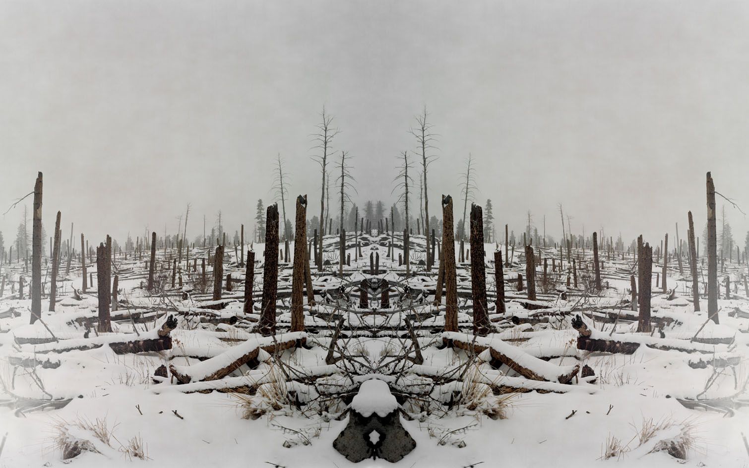
 coalesced into one mega-fire which could not be fully contained until December 31. Seven years later, the remnants of the burnt trees slowly creep up this foggy hillside.")
2002 Biscuit Fire, Kalmiopsis Wilderness, Oregon-7 Years Later
Having burned 499,965 acres, the Biscuit Fire that devastated southern Oregon and Northern California is by far the most disastrous wildfire in the region’s contemporary history. In July of 2002, two rapidly approaching lightning-caused wildfires (the Florence Fire and the Sour Biscuit Fire) coalesced into one mega-fire which could not be fully contained until December 31. Seven years later, the remnants of the burnt trees slowly creep up this foggy hillside.
-

Flagstaff, Arizona
I saw this fire taking place on the road out of Flagstaff on November 24, 2008. The mountains pictured are the San Francisco Peaks, which I had embarked upon earlier that morning. There had been little evidence of past fire activity and only upon departing a few hours later was I able to spot this fire on the horizon.
-

2008 Tea Fire, Montecito, California-10 Days Later
Montecito is a picturesque and wealthy enclave next to Santa Barbara along the Southern California coast. This fire began on the evening of November 20, 2008 and quickly spread across the mountains surrounding the town
-

2008 Tea Fire, Montecito, California-10 Days Later
I spoke with a resident whose home was destroyed in the blaze and who expressed her thankfulness to be alive on the one hand, but also anger considering that primary attention had been paid to saving the houses owned by celebrities. Actor Christopher Lloyd saw his own home destroyed.
-
![Old Fires, Lookout Tower, Wenatchee National Forest, Central Washington]()
Old Fires, Lookout Tower, Wenatchee National Forest, Central Washington
-

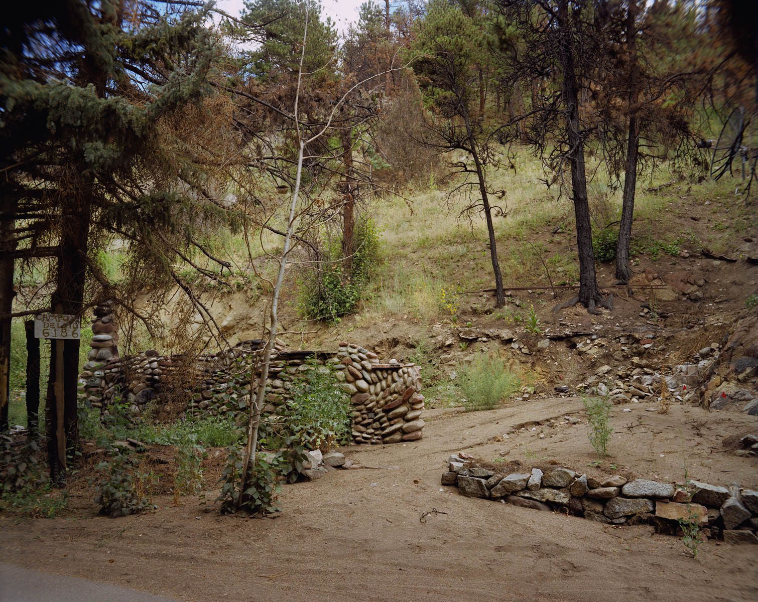
Art Arias, Site of 2008 Kincaid Fire, Outside of Carlsbad, New Mexico-9 Months Later
The Kincaid Fire lasted three and a half days and scorched 4,000 acres near the Pecos River between Artesia and Carlsbad, New Mexico. The June 2008 wildfire was human-caused, and most likely a case of arson, which Art says he sees in his ranger district fifteen to twenty-five times a year on average. As Incident Commander, Arias was responsible for coordinating the various efforts related to suppressing the fire, which took place in an area interspersed with pump jacks and oil derricks, with petroleum being one of the biggest contributors to the regional economy.
-

2008 Summit Fire, Santa Cruz Mountains, CA
Summit Road is a windy and often narrow dirt route into the area burned on the mountainous border of Santa Cruz and Santa Clara counties. In all 4,270 acres were consumed. The day I was there one could hear shotgun blasts echoing off of the canyons. Needless to say this was positive reinforcement to not intrude on private property
-
![2011 Norton Point Fire, Bear Creek, Wyoming]()
2011 Norton Point Fire, Bear Creek, Wyoming
-
![2010 Four Mile Canyon Fire, Gold Hill, Colorado-1 Year Later]()
2010 Four Mile Canyon Fire, Gold Hill, Colorado-1 Year Later
-

2002 Rodeo-Chediski Fire, Show Low, Arizona-6 Years Later
Originally two separate incidents, the Rodeo Fire started by an arsonist, and the Chediski by a stranded motorist, these fires eventually merged and consumed 467,066 acres in the summer of 2002. The largest wildfire in Arizona history, several towns were evacuated and saw homes destroyed, Show Low among them.
-

Jim Paxon, Chief Information Officer, 2002 Rodeo-Chediski Fire, Truth Or Consequences, New Mexico
Jim Paxon worked for various forestry agencies and also as an alternate on wildland firefighting outfits for 34 years. As Chief Information Officer on the 2002 Rodeo-Chediski fire in Arizona, Paxon became the “face of the firefighters” and consulted with and advised then President Bush on the various aspects of the incident as well as the larger contemporary situation concerning wildfires, of which the “Healthy Forests Restoration Act” of 2003 has been the most significant result. Jim has also authored his own account of this specific fire that addresses the broader context of these events in relation to natural and human developments.
-

Yosemite National Park, California
I photographed this prescribed burn in Yosemite on a moonless night in which only the flames provided any sense of illumination. Prescribed Burns mimic the 16,000 acres the park should naturally lose to wildfires each year. At night, the atmosphere is surreal.
-

Ernest & Rodney, Inmate Crew, 2009 Chalk Fire, California-Day 13
Inmate crews work alongside wildland firefighters often performing the same 16 hour shifts expected of their counterparts. The Chalk Fire spread through a remote area near Mount Shasta that caused the evacuation of a number of small communities outside of Burney. I was granted media access through CalFire and couldn’t believe the weight of the camera equipment’s effect on sliding through ash in 100-degree heat in the same orange NOMEX suit as the personnel.
-
![1998 Oso Complex Fire-11 Years Later]()
1998 Oso Complex Fire-11 Years Later
-

1933-51 Tillamook Burn, Oregon-58 Years After Last Fire
Four catastrophic fires burned every six years, each having been ignited accidentally by logging operations. Nearly 350,000 acres were devastated and existed as an endless wasteland of charred trees well into the 1970's. The entire forest has been re-planted and represents a 70-year effort of re-seeding coordinated through government agencies, schoolchildren, volunteers, and prisoners. This is the largest such effort ever conceived in United States history.
-

Tillamook Burn, Oregon, Chris Friend, Tillamook Forest Interpretive Coordinator, Douglas Fir Snag
Chris Friend is the coordinator of the Tillamook State Forest Interpretative Center. Chris has fought past fires throughout the west coast, and in this picture he stands next to a charred remnant of the Tillamook Burn. Douglas Fir’s are exceptionally large trees, and while the re-forestation of the Burn has surpassed all expectations, it will take centuries to replace the dense stands of old growth trees which had once towered above the forest floor.
-

1902 Yacolt Burn, Washington-107 Years Later
The Yacolt Burn was the worst wildfire in Washington’s history and killed 38 people. The 250,000 acres that burned are no longer visible in this contemporary photograph and over a century later there is essentially no evidence remaining due to the natural regeneration of the area.
-
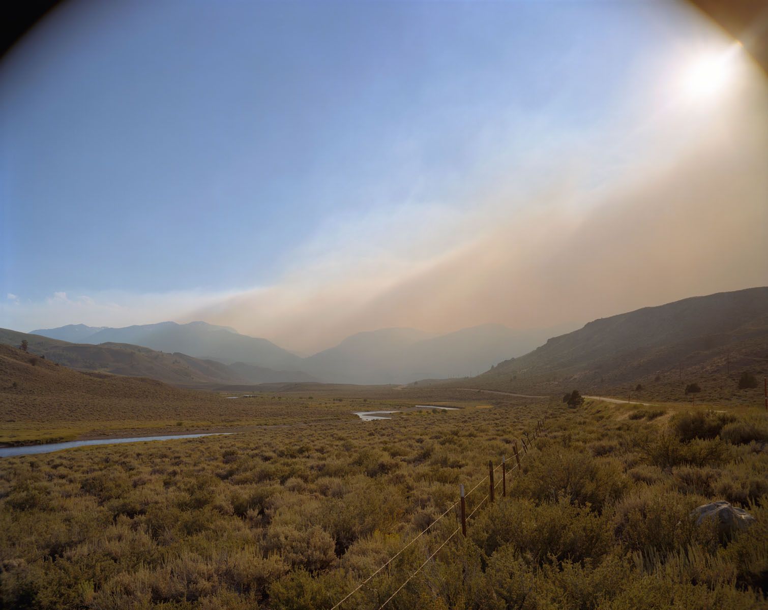
![2011 Motor Fire, Eastern Sierra Nevada, California]()
2011 Motor Fire, Eastern Sierra Nevada, California
-

2006 Tripod Fire, West of Tonasket, Washington-3 Years Later
The Tripod Fire was a mega-fire that surpassed 500,000 acres. This isolated location is roughly twenty miles west of Tonasket and at its perimeter less than 5 miles from the border with British Columbia. The undergrowth is now lush but the rolling hills of dead snags thickly populate a wilderness devoid of human presence.
-

2008 Martin Fire, Bonny Doon, California-1 Year Later
The Martin Fire forced the evacuation of Bonny Doon and a few other unincorporated communities in the Santa Cruz mountains. Several homes were destroyed in the incident and another photograph depicts Steve Sohl & Ryan Koch, who saved their house through an exhaustive all night battle with the neighboring flames. There was another fire only two months after this picture was taken which again forced the evacuation of the same area.
-

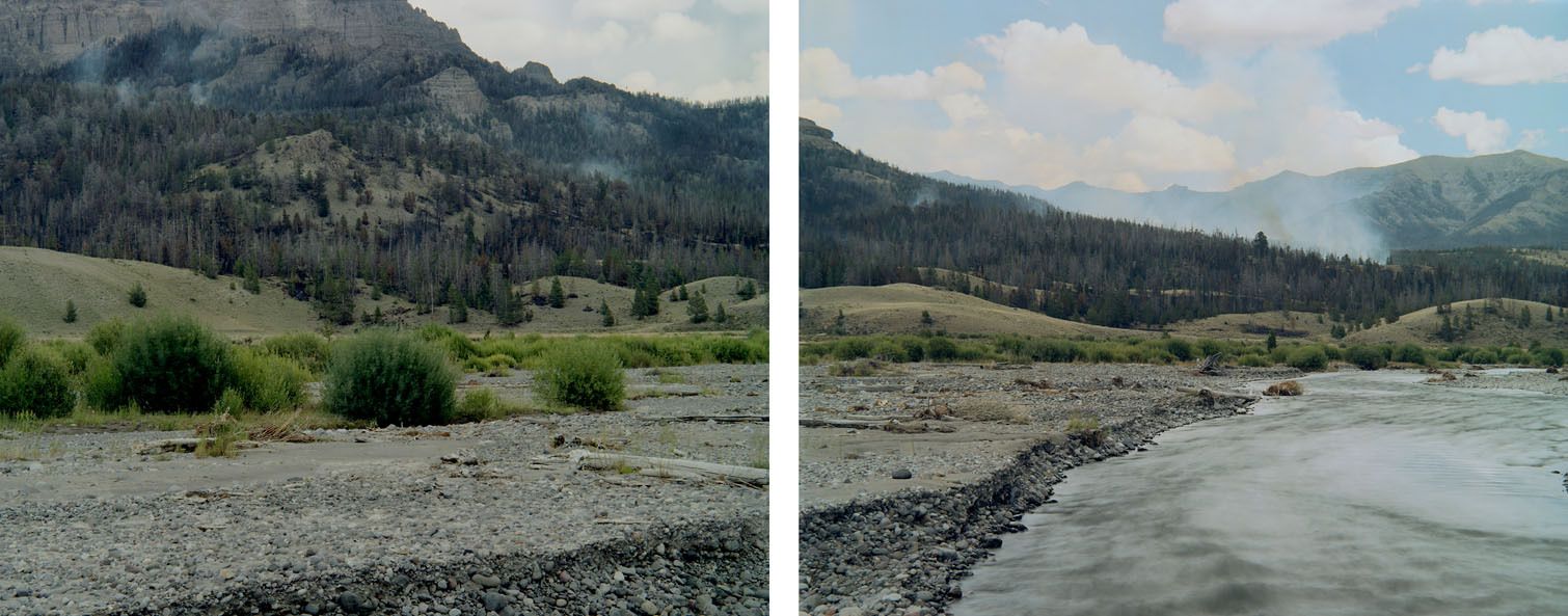
2003 B & B Complex Fire, Central Cascades, Oregon-6 Years Later
95,000 acres burned in this fire that eventually crossed both sides of Highway 20 in the Central Cascades of Oregon. This view is towards the southwestern extent of the damage with the glacier on Mount Washington visible near the center of the photograph.
-

Bill Smith, Wildland Firefighter, Site of 2008 Double Day Fire, Oregon-4 Months Later
Bill Smith has worked for the Oregon Department of Forestry fighting fires for 17 years. The community of Butte Falls in southwestern Oregon, where Bill resides, was threatened by the blaze, but the firefighters were able to contain the burn area to the higher elevations of timber that descend upon the town.
-

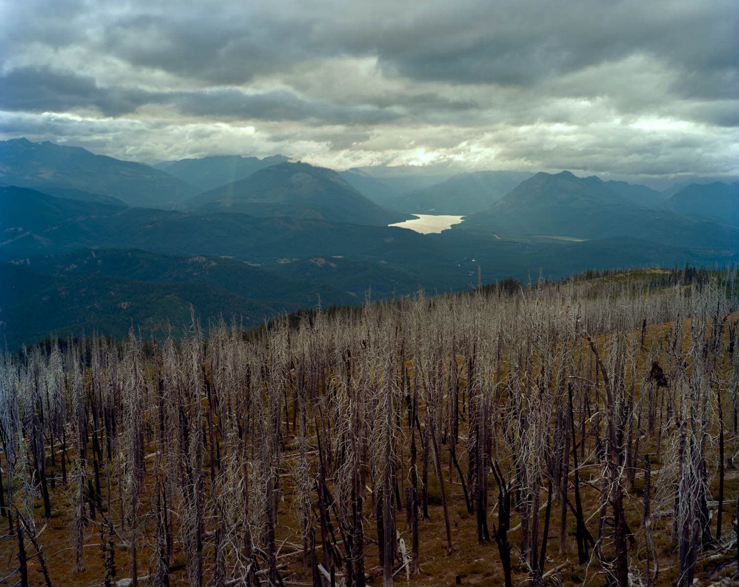
2009 Arnica Fire, Yellowstone National Park, Wyoming-2 Years Later
A lightning strike started the Arnica fire on September 13th 2009. The wildfire slowly grew to consume over 9,000 acres of the Yellowstone National Park and particularly areas close to Yellowstone Lake. The burn still appears fresh as of August 2011.
-

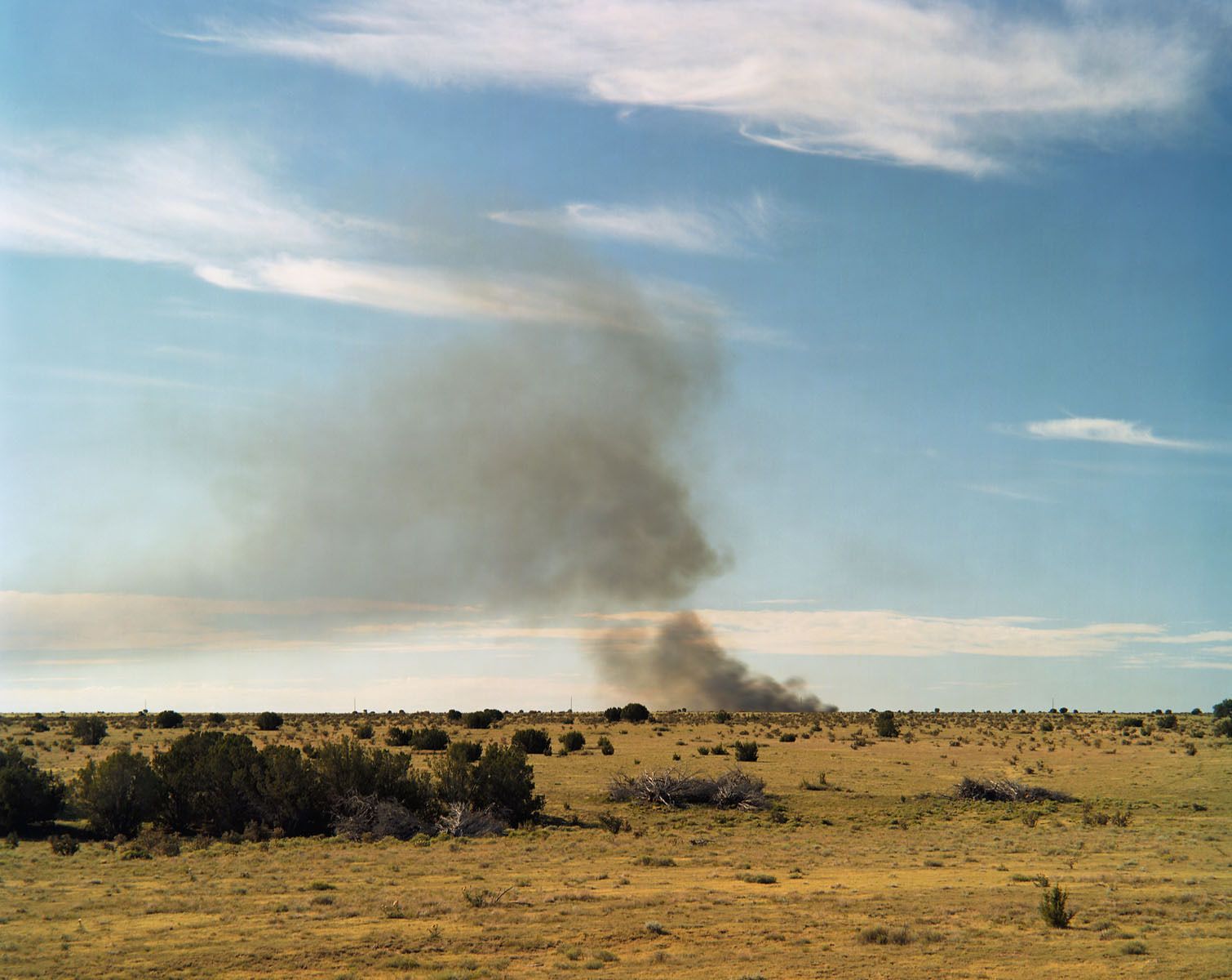
2009 Pacheco Fire, West of Los Banos, California
Originally I was heading down Route 101 to go into another fire with media access, but in the distance subtle signs of smoke could be seen over the hills nearing the road to Los Banos. The fire started when a car accident caused flames to quickly spread through the bone-dry hills and only upon arrival did it actually erupt as I was setting up my camera.
-

2009 49er Fire, Auburn, California-4 Days Later
On August 30, 2010 a 500 acre wildfire destroyed or damaged sixty homes in Auburn, a town in the foothills of the Sierra Nevada Mountains.
-

2009 Lockheed Fire, Santa Cruz Mountains, California
The Lockheed Fire seen in progress here forced the evacuation of several towns that regularly find themselves in the path of summer wildfires. Bonny Doon and other communities had lost homes the previous summer in the 2008 Martin Fire, which I have separately recorded.
-
 build up which in turn creates more intense fires.")
Los Angeles, CA
This hillside descends to the I-405 freeway near the Getty Center in Los Angeles, a metropolitan area particularly prone to wildfires. Western sprawl cities encroach upon the Wildland Urban Interface and disrupt the natural cycles of fire. The necessary efforts to save human life and property often result in excess fuel (vegetation) build up which in turn creates more intense fires.
-
![Wildfire, Southwest Colorado]()
Wildfire, Southwest Colorado


 build up which in turn creates more intense fires.")